
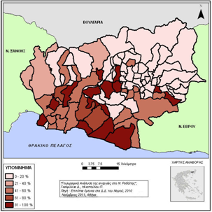
Γεωγραφική ανάλυση της ανεργίας στο Ν. Ροδόπης
Περίληψη
Λέξεις Κλειδιά: γεωγραφική ανάλυση, ανεργία, Ν. Ροδόπης (Ελλάδα)
ABSTRACT: The purpose of this study is to analyze the factors which affect the geographical distribution of unemployment in the prefecture of Rodhopi (Northern Greece). More specifically, in this study the relationship between unemployment rate and a series of indicators such as employment in the productive sectors, educational level, gender, religion and the topography of the region, was analyzed employing data at the municipality level. Some of the data were collected through the conduction of a survey in the villages of Rodhopi. The rest of the data come from the databases of the Hellenic Statistical Authority. The relationships between the factors were tested mostly through a chi-square test. Also, a Pearson correlation coefficient was applied in order to test linear associations. The results indicated that there is a statistically significant association between unemployment rate and employment in the three productive sectors (primary, secondary, tertiary), gender, religion and the topography.
Keywords: spatial analysis, unemployment, Rodhopi (Greece)https://doi.org/10.26234/HEAL.IHU.B2TE-EA24
ISSN: 1792-3913
Copyright © 2010
Τμήμα Γεωπληροφορικής & Τoπογραφίας, ΤΕΙ Σερρών